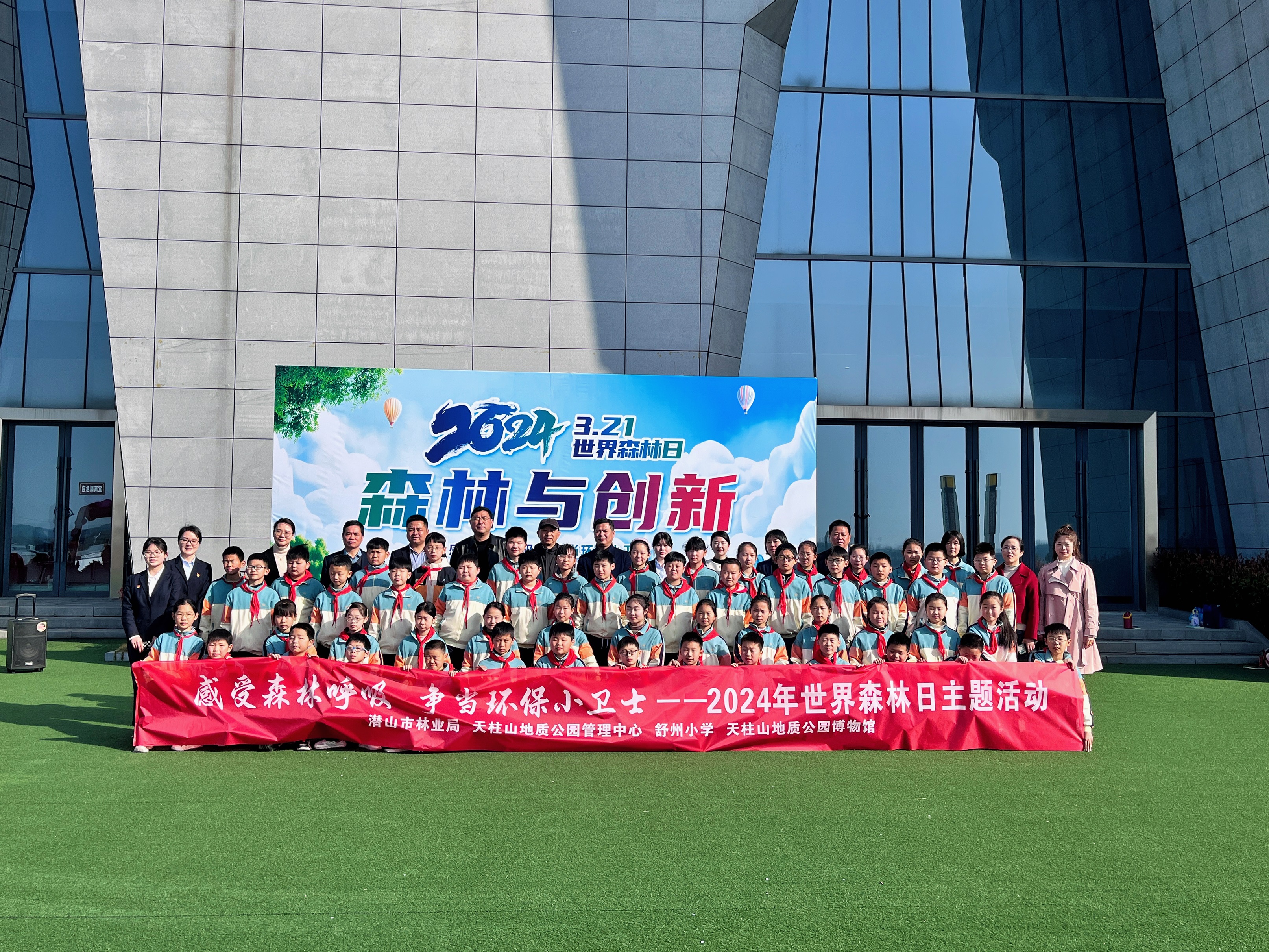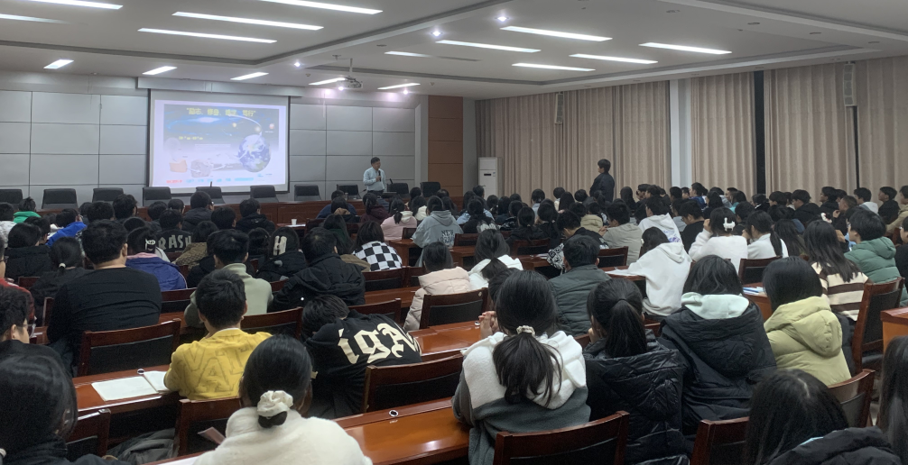
April 22, 2023 is the 54th World Earth Day, and the theme of this year's Earth Day is "Cherish the Earth, Harmony between Man and Nature". To further guide the whole society to establish the ecological civilization concept of "respecting nature, adapting to nature and protecting nature", promote the construction of beautiful Qianshan, and jointly build an earth home where people and nature live in harmony, Tianzhushan Global Geopark and Shuzhou Primary School of Qianshan City will jointly hold a series of thematic publicity activities for the World Earth Day 2023.
More
Details
UNESCO’s Executive Board today approved the designation
of eight new sites demonstrating the diversity of the planet’s geology as new
Geoparks. The Executive Board also approved the extension of three existing
Geoparks. With this year’s additions, the number of sites in the Global UNESCO
Geoparks Network is brought to 147 in 41 countries.
The newly designated sites are:
Kütralkura, Chile
The Kütralkura UNESCO Global Geopark, which in the language of the Mapuche
people means stone (kura) and fire (kütral), or firestone, is characterized by
some of the world’s most active volcanism. It is situated 700 km south of
Santiago and reaches the border of Argentina to the east. It encompasses the
municipalities of Curacautín, Vilcún, Lonquimay, and Melipeuco, settled by
their indigenous inhabitants two millennia ago. Its iconic peaks are mostly
active volcanoes such as Llaima, Lonquimay, Tolhuaca, and Nevados de
Sollipulli, as well as an extinct volcano, the Sierra Nevada. The thick ice
masses that once partially covered the territory, have been shrinking for the
past 20,000 years.
Funiushan, China—Extension
The Funiushan UNESCO Global Geopark is located in the east section of
Qinling Orogenic Belt and collision zone between the North China plate and
Yangtze plate. Its unique geological structure and complex activities account
for its rich geoheritage, which includes paleontological fossils and exquisite
granite land formations. It is in this region that researchers discovered
groups of fossilized dinosaur-eggs, unmatched in terms of range of
distribution, quantity and variety. The fossils have international significance
in the study of paleobiology and global geological issues, such as the
evolution and extinction of cretaceous dinosaurs. The Funiushan landforms are
constituted by a series of granite peaks and walls, the deep Jiguan and Tianxin
Caves, tectonic rock formations, waterfalls and pools formed by the site’s
rapid uplift process.
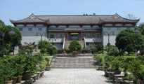
Jiuhuashan, China
The UNESCO Global Geopark of Jiuhuashan, which translates to “Nine
Glorious Mountains”, is located in the Qingyang County of China’s Anhui
province. Four of them are crowned by sacred Buddhist temples, some dating back
to the fifth century CE, on their peaks. Beyond their religious, historical and
cultural significance, these mountains also provide a major source of the fresh
water that feeds the Yangtze River system. Jiuhuashan’s unique and favourable
geological conditions have contributed to the flourishing of the region’s
biodiversity and cultural traditions. In 2016, the natural landscape of this
area and its religious sites attracted 9.9 million visitors, a major economic
contribution to local communities.
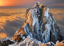
Sanqingshan, China—Extension
The Sanqingshan UNESCO Global Geopark is located in the territory of
Shangrao City, Jiangxi Province, in southeast China. The natural beauty of
Mount Sanqingshan derives from the juxtaposition of granite stone and
vegetation in a landscape that is ever changing visually due to meteorological
factors. The history of Sanqingshan, one of the birthplaces of Taoism,
dates back more than 1,000 years. It retains 238 Taoist relics and other
important emblems of cultural heritage such as ancient academies, dwellings, a
theatre, monumental halls and more. The region, largely inhabited by the Han
people and the She ethnic group, is home to traditions like Gan Opera, Madeng
Drama, and the Hetangjiu Banquet.
Taishan, China—Extension
The Taishan UNESCO Global Geopark is located in the eastern part of the
North China Plain, at the centre of Shandong province. Mount Taishan, which
rises majestically above the many peaks that surround it, preserves rich
cultural heritage dating back more than 5,000 years. The mountain has spiritual
significance and has become a major tourist destination for both domestic and
foreign visitors. The 158.63 km2 Geopark is composed of eight areas of
exceptional scenic beauty: Hongmen, Zhongtianmen, Nantianmen, Houshiwu,
Taohuayuan, Culaishan, Lianhuashan and Taoshan. Its unique, abundant
geoheritage makes this Geopark a natural geological museum.
Yimengshan, China
The Yimengshan UNESCO Global Geopark is located on the eastern coast of
China, near Jinan City, the capital of Shandong Province. The site is home to
one of Asia’s largest kimberlite-type diamond mines, the first primary diamonds
discovered in China. The landscape is dotted with Daigu, castle-shaped land
formations, as well as multiple sites of cultural heritage, including the Zhou
dynasty Wanshou Palace, the Xialou Pavillion where Confucius is believed to
have once visited, the 1,500 year old Marshal tree, the Menglianggu Battle
Monument, and several renowned temples.
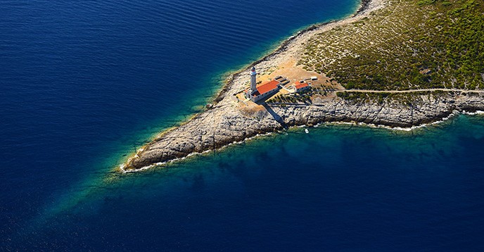
Vis Archipelago, Croatia
The Vis Archipelago UNESCO Global Geopark is located off the coast of
Croatia, formed by some of the oldest rock in the Adriatic Sea. The
northeastern region of the archipelago features large sand deposits formed by
fierce winds in the Ice Age, which also created several unique caves and land
formations. Before the sudden rise of the sea level around 12,000 years ago,
these islands were much larger and extended more than 20 miles. In this
extended area, called the Mala Palagruža, archaeologists discovered flint
quarries that served for the production of early tools, believed to have been
made by the islands’ first inhabitants up to 8,000 years ago. Some of the most
famous sites on this Archipelago are the Blue Cave (Modra špilja) and the Monk
Seal Cave (Medvidina špilja).
Imbabura, Ecuador
The Imbabura UNESCO Global Geopark is located in the northern inter-Andean
region, in the Republic of Ecuador. It is known for its great multitude of
lakes and magnificent geological formations, such as the Peguche Waterfalls.
The highest summit is of this Geopark, the 4,939 metre high Cotacachi Volcano,
is located within the Cotacachi Cayapas Ecological Reserve. The provincial
capital, Ibarra, also known as the “White City,” encompasses indigenous
villages and colonial towns attracting thousands of visitors every year. This
area is currently inhabited by different ethnic groups, among them the
Caranqui, the Cayambis, the Otavalos, the Zuletas, the Natabuelas, the
Montubio, the Afro and the Awa.
Trollfjell, Norway
The Trollfjell UNESCO Global Geopark is an area with unique
characteristics shaped by a long history of human habitation. While some of
this area’s bedrock is poor in nutrients, resulting in barren stretches, others
are fertile supporting lush vegetation and considerable biodiversity. Naturally
occurring soapstone has been exploited locally since the Iron Age, to make
utensils ranging from pots to fishing weights. Archaeologists have discovered
soapstone quarries dating back to Viking period, which in the 12th and 13th
supplied stones used to build churches. Passages in Trollfjell’s Solsem Cave
feature prehistoric rock engravings of dancing stick figures, dating back
thousands of years.
Colca y Volcanes de Andagua, Peru
The Colca y Volcanes de Andagua UNESCO Global Geopark, in the Southern
Peruvian Andes, boasts a vast array of volcanic landscapes, lakes, geological
faults, pre-Hispanic ruins and colonial churches. Formed 400 million years ago,
the landscape features the great Colca Canyon, one of the largest and deepest
in the world. The landscape of the Geopark, one of the few areas in the world
with a multitude of volcanic cones, has been carved by rivers of lava and
melting glaciers. This majestic scenery is known as Valley of Volcanos Andagua,
extending between the Colca Canyon-Ayo, Chachas-Andagua and Orcopampa.
Most of the inhabitants of these territories belong to pre-Hispanic cultures, heirs
to rich customs, festivals and dances, many of which connect them to their
unique, volcanic-tectonic territory with its hot springs and highly arable
soils.
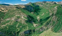
Courel Mountains, Spain
In the northwest region of Spain, the Courel Mountains UNESCO Global
Geopark is home to a variety of Galician communities living in what remains of
small medieval villages and monasteries. The territory’s deep valleys and
canyons have been formed by erosion. The remarkable aspect of its mountains is
impacted by mining, reflecting the relationship between humans and the mineral
resources of the region’s Paleozoic rocks, which separate the peninsular
interior from the Atlantic facade. Between the first and second century CE, the
Roman Empire is believed to have operated dozens of gold mines in this region,
extracting Paleozoic primary gold associated with the erosion product of
gold-bearing quartz dykes and concentration of their deposits. Remnants of
pre-historic fauna and flora, as well as Neolithic paintings, can also be found
well-preserved within the deep caves of the mountains.